Inching toward the sea, just a little bit closer, just a little bit, "dang it!" What should have been a little toe tap in the ocean turned into a full foot soaker, and so I began my 38 mile run up Maui's largest, central volcano. Originally I had wanted to run the 18-20 mile route up the Kaupo Trail, but having heard mixed reports about whether or not it was still open to the public and not having anyone to join me, I opted for this safer alternate up the mountain. This proved all the better choice upon my arrival to the Hawaiian island, given inclement weather persisted for a time each day and the trails were slick, if not unsafe as a result.
I had chosen Monday, March 06, 2023 as the day for this FKT attempt, partly because it was in the middle of my vacation window and partly because it was one of the better forecasted days for weather. I watched the forecast diligently during the five days leading up the the sixth with a mixture of excitement, hope and anxiety. A series of storms were moving in beginning the afternoon of my run. I didn't mind the rain so much, but a low temperature of 38 degrees and predicted gusts of up to 95 miles per hour come that Wednesday gave me pause. With bated breath I waited and watched.
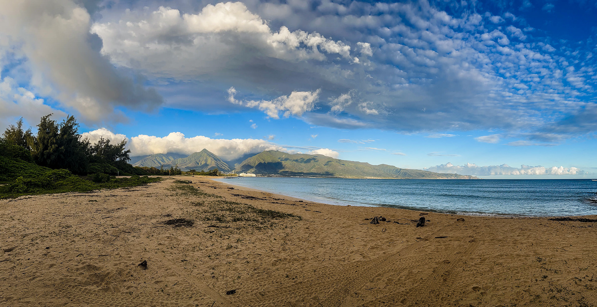
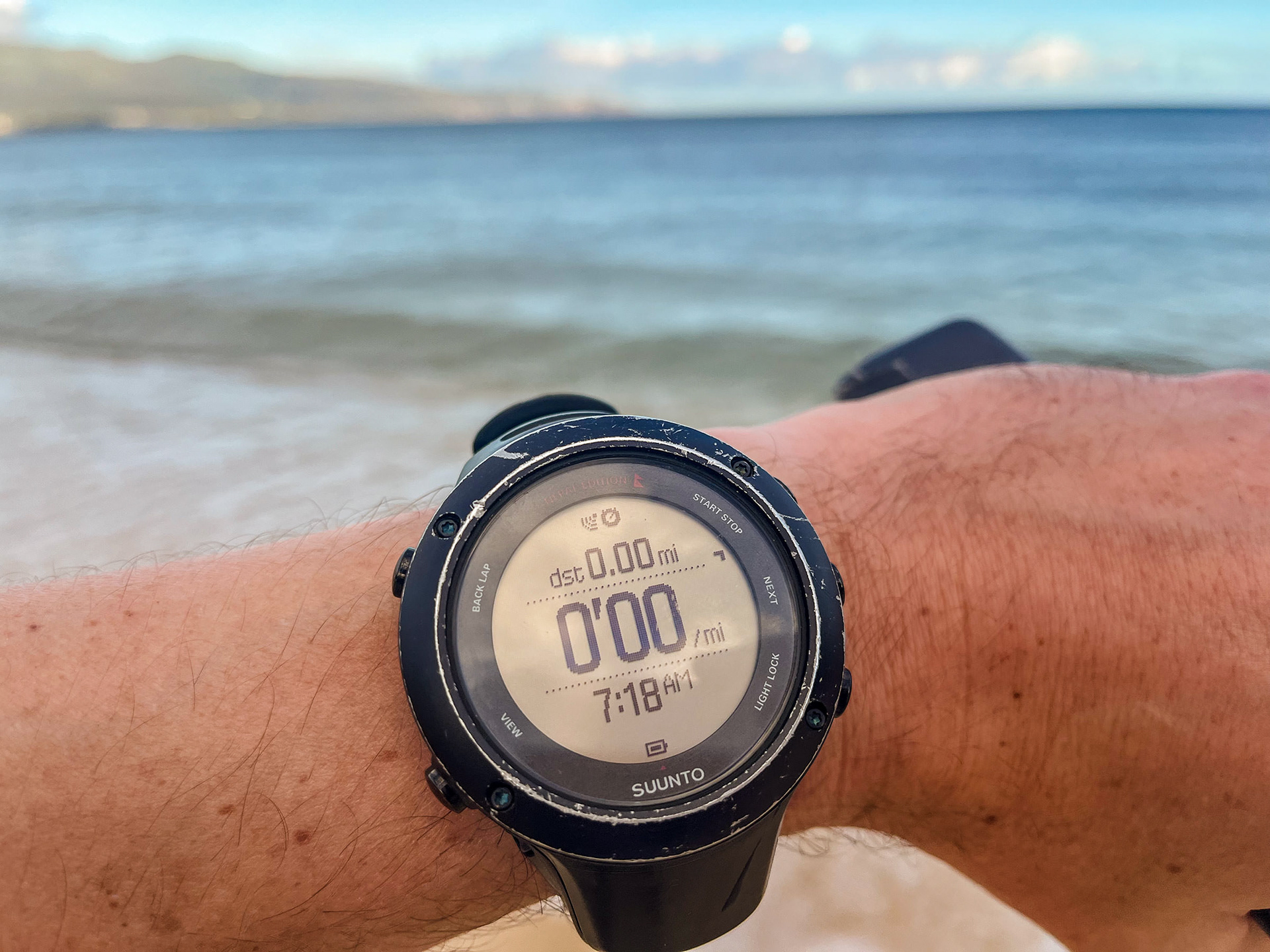
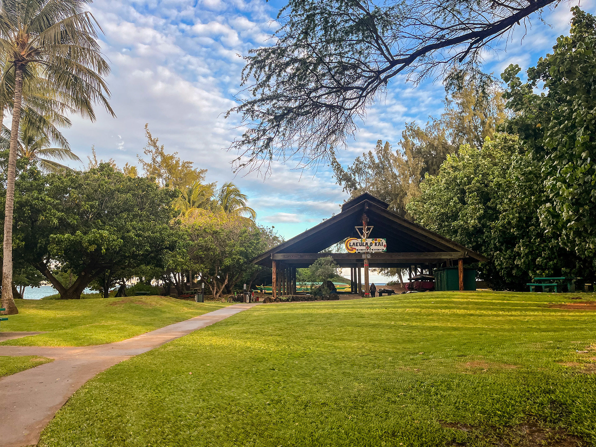
Because of the uncertainty of conditions I waited until the night prior to make my intentions public on the FKT website. The next morning I awoke to a partly cloudy sky and sunshine, a bit muggy, but overall very pleasant. Knowing the good weather wouldn't last long past midday put pressure on my morning and made it feel all the more like a pre-race routine. Within an hour and a half of waking I had thoroughly applied sunscreen, eaten my bowl of granola, had a few cups of coffee and was out the door. My in-laws, Dan and Ann Rogers—these two get a huge shout out of applause, because if it weren't for their generosity and hospitality I would not have been in Maui to begin with—drove me to the start line at Kanaha Beach near the airport, the official start of the route. Due to the nature of my run being unsupported I wouldn't see them again until the finish at 10,023 feet above sea level.
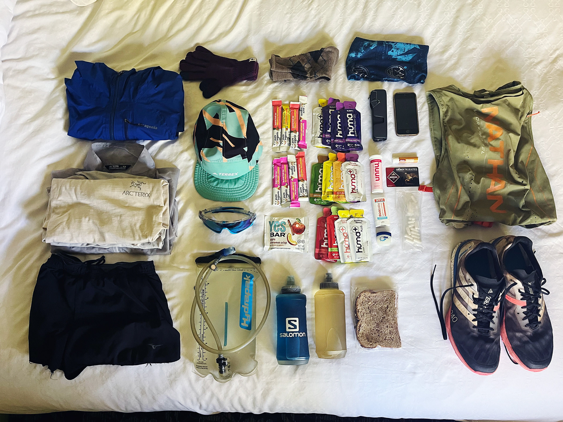
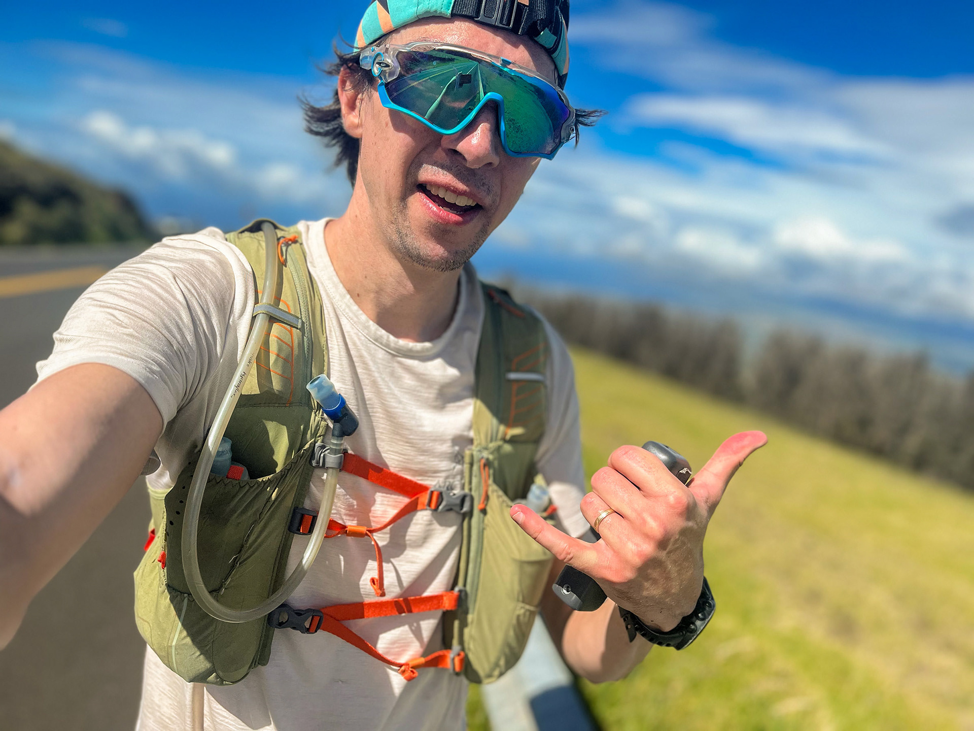
I set off just after sunrise with a loaded vest containing 3 liters of water, 12 Huma gels, 1 granola bar, 1 peanut butter and honey (local and delicious) sandwich, 8 fruit rolls, a handful of salt tabs, my phone, the dji osmo pocket camera and a mixture of clothing to accommodate the various microclimates I was about to enter.
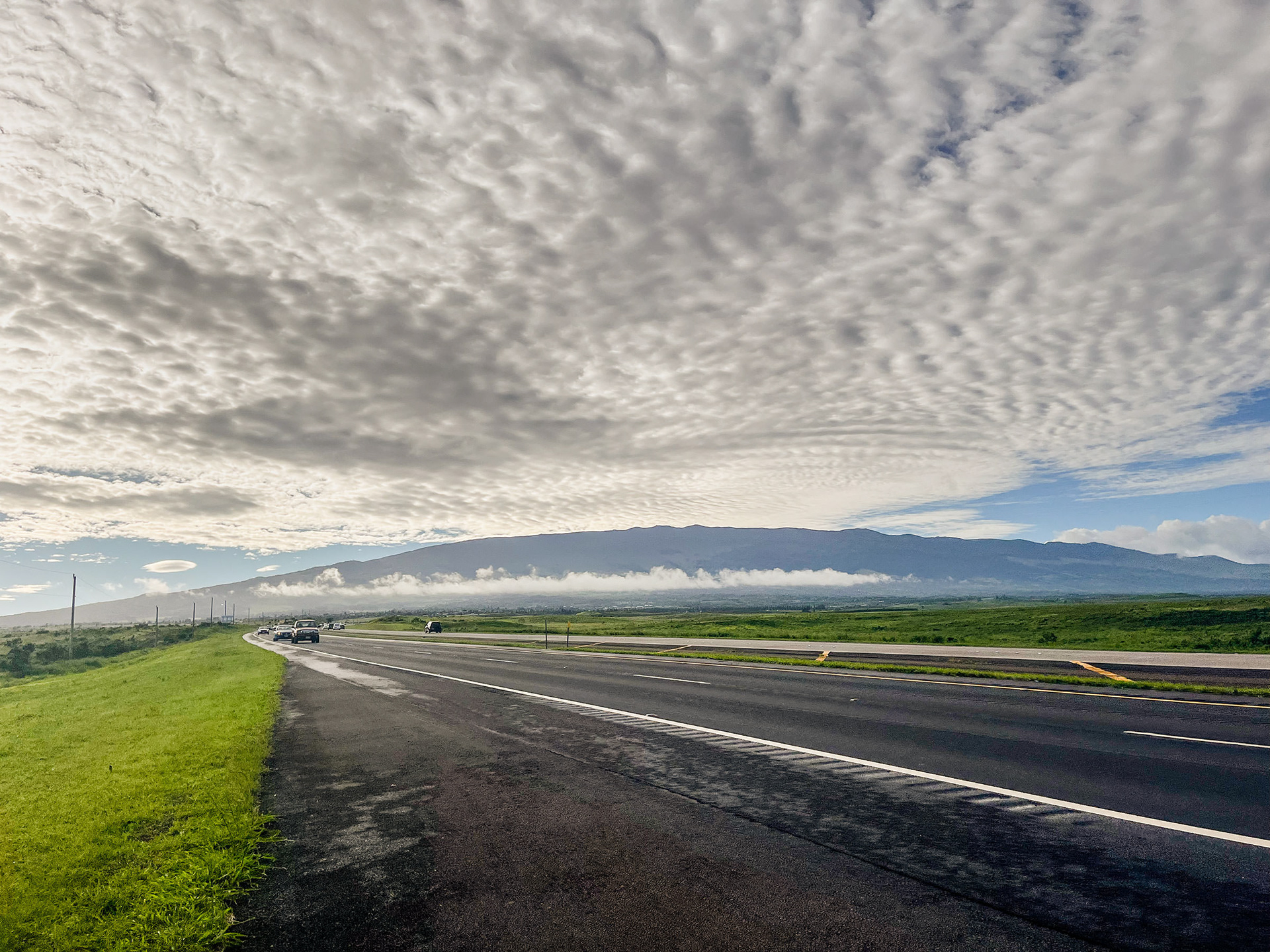
Running through the airport grounds and up the Haleakala Highway went by a bit swifter and smoother than expected. I entered Pukalani at mile 10 within 1hr and 30min, then ticked off another 90min stretch in similar timing to above Kula. In this time high clouds began to form above the mountain and lenticular clouds were visible off the shore beyond West Maui. While the combination of cooler temperatures associated with these clouds and the increased elevation felt good, it also meant I was almost certain to encounter some of the incoming storm.
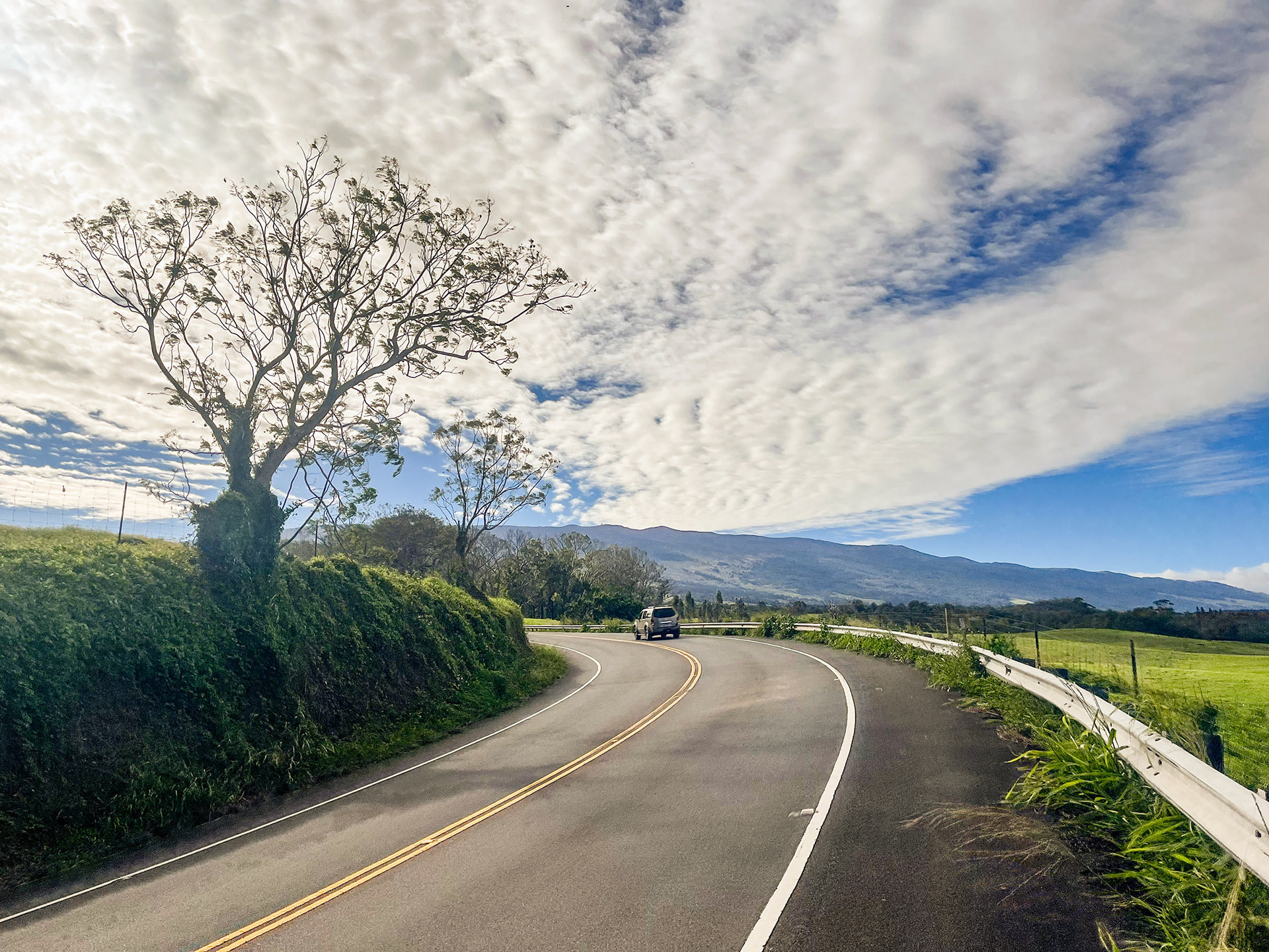
I continued climbing with one eye fixed upon traffic zipping around every hairpin turn and another on the cascading sheets of rain down where I'd begun my run three hours prior. Often there were breaks of silence from the passing cars and I would have a long opportunity to watch the weather more closely, or even better just look about at the varying landscape. At times my surroundings were full of dense deciduous trees that resembled Northern California. Around a bend the terrain would alter to look more like the fells of Scotland. Still further up and I had entered a pine forest before ultimately ascending into the national park and a typical looking volcanic setting of lava rock, black sands and shrubs.
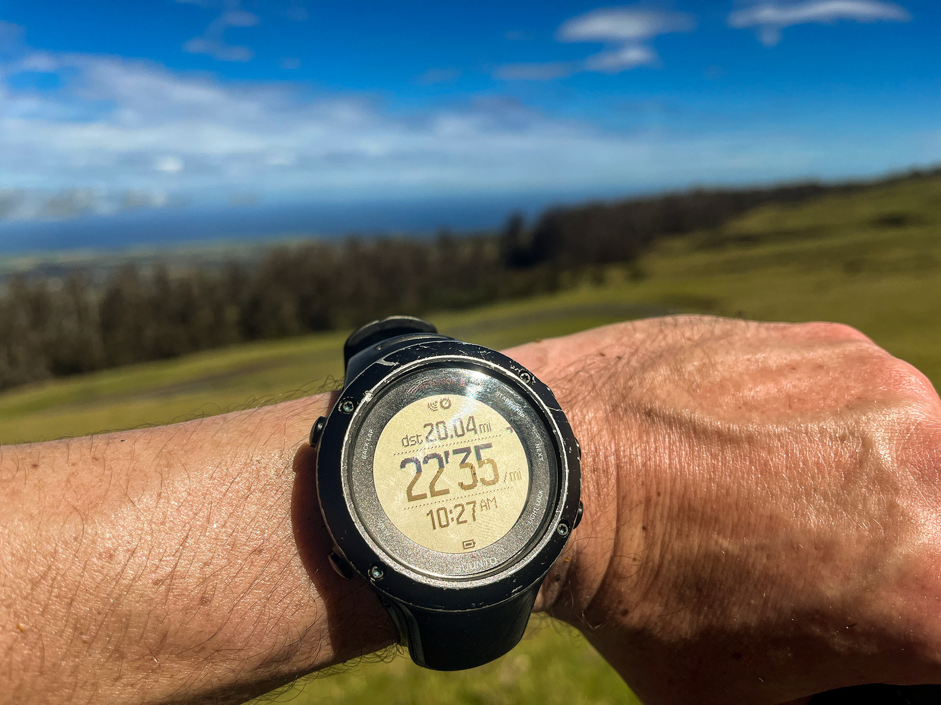
I encountered the first of Haleakala's visitor centers at mile 28 and consequently the first opportunity to refill my depleted water. Taking on three liters once more felt like overkill, and it definitely didn't feel good on my sore neck and shoulders, but my rate of consumption seemed to be increasing with every new mile and I was grateful that utilizing this source was still considered unsupported. Better safe than sorry, I thought. During this brief respite I also ate the 2nd half of my PB & honey sandwich, the first half of which I consumed while walking some miles earlier. Afterward I again walked, probably no more than a quarter mile, then resumed running with the hope it would all stay down. It did.
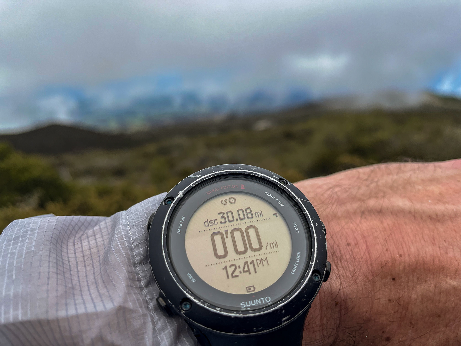
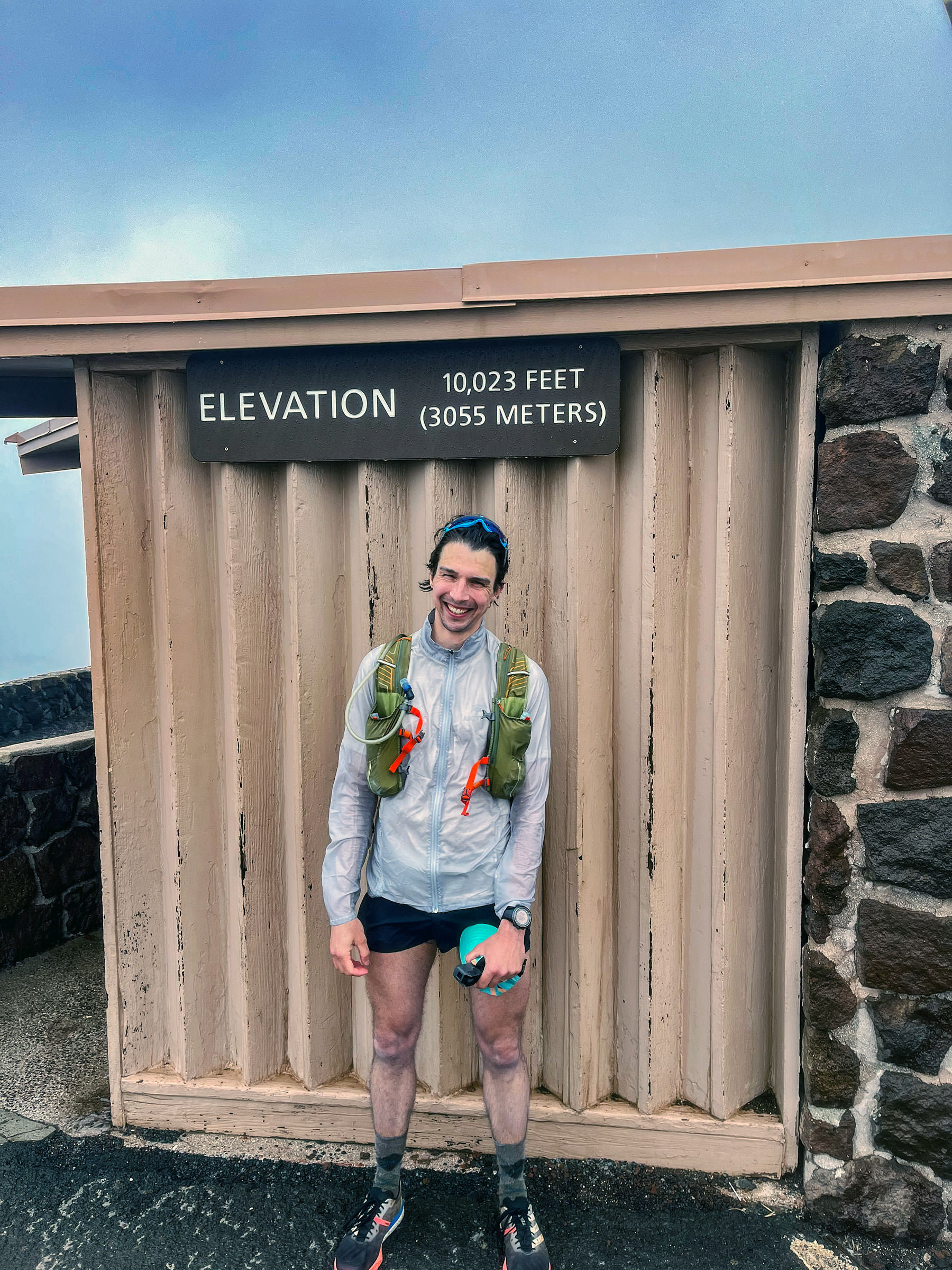
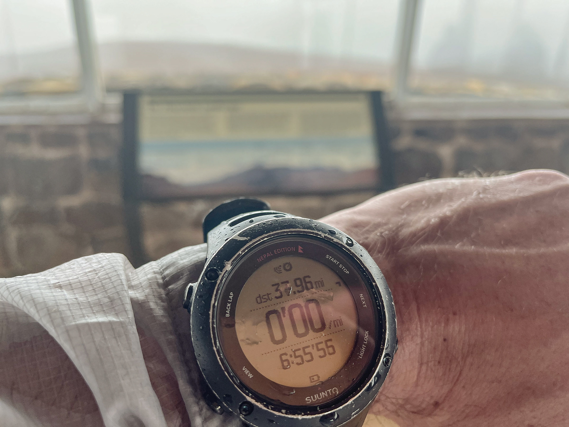
The final 10 miles are, as one would expect, not easy. This was in part due to the previous 28 miles I had already run and the 7,000 feet of vertical gain I had already attained, but increased head winds were an added element. These winds grew in intensity the higher I went until, within the final mile, I was forced to a stagger despite my best efforts to run. Fifty-five mile per hour sustained winds and sideways sleet numbed my hands and blurred my vision. Passing cars no longer took on much shape, but their headlights remained visible. I would have stopped to put on another layer if not for fear of losing my jacket to the void. I also knew I was close, so close, to the end. As I rounded the corner to the final parking lot I could see a soft, obscure figure shouting with applause in the distance who I took to be Ann. I touched the summit elevation placard, gave my mother a high five and stared bewildered into the surrounding whiteout. I had managed to set a new unsupported FKT: 6 hours, 55 minutes and 59 seconds.